Signs, Maps, Zones, Access & Times
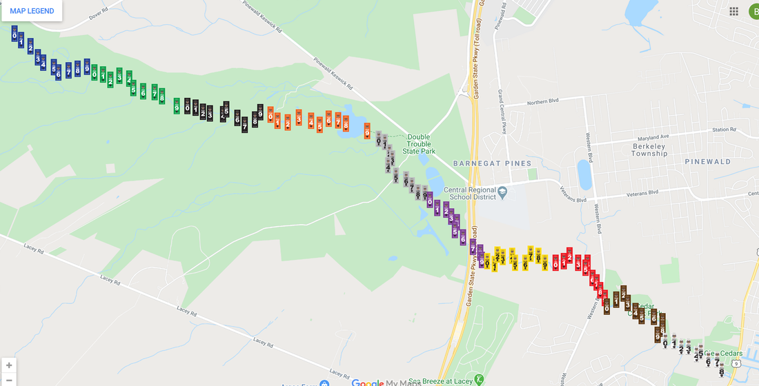
There are 100 signs marking 10 miles of the Cedar Creek. Each mile on the route is marked with a different color, each color has 10 numbered signs (0-9). Signs are placed about 1/10 miles apart. Signs and locations were approved by the New Jersey Department of Environmental Protection through a land management review and wildlife study. An interactive Google Map can be found here (or click the image below).
|
Zone Colors & Access Points:
Blue Dover Forge - Blue Zone 0 Green Black Orange Ore Pond - Orange Zone 0 Ore Pond Dam - Orange Zone 9 Light Grey Double Trouble - Light Grey Zone 5 Purple Yellow Red Western - Red Zone 8 Brown White Trestle - White Zone 5 Dudley Park - White Zone 8 |
Approximate Travel Times:
Dover Forge > Dudley Park 7-8 Hours Ore Pond > Trestle 4-5 Hours Double Trouble > Trestle 3-4 Hours Western > Trestle 1-2 Hours Points of Interest:
Ore Pond Dam Crossover Orange 9 Bathing Beach Purple 6 Rope Swings After Yellow 1 & Yellow 6 Western Red 8 |
©2020, GPetry

